HIS survey managemet: Main
Survey Area is a folder
with data from survey lines, files containing area borders, meta-data, defined underwater objects and all processed depths.
All in simple ASCII format.
HIS is set to read these files and automatically fill/update database from them.
All survey data together with metadata can be uploaded to HIS and later downloaded for data cleaning or for using in other systems.
Metadata can be edited and later exported.
The system tracks the status of survey areas, logs, who changed the data, what operation did he do and when was it carried out.
When an area is processed, its status changes and the change is immediately visible to the other users of HIS.
Object data can be further managed in HIS, e.g. object type can be changed from obstruction to wreck, data added from other sources, etc.
Survey areas are spatially classified by
- IHO44 standard
- survey time
- survey stage.
A sample list of surveys made by Estonian Maritime in 2019
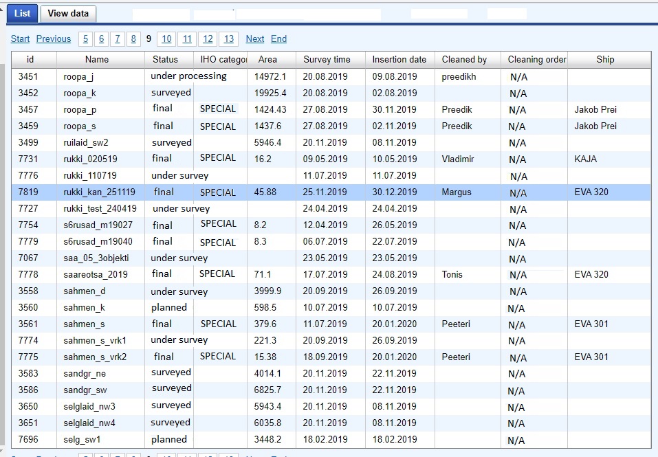
List of surveys
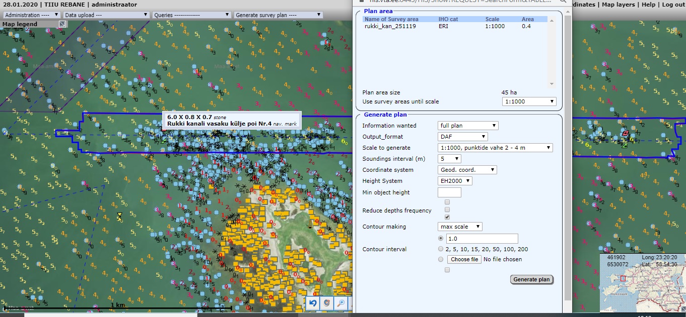
Detailed data and statistics of a chosen Survey

Detailed data and statistics of a chosen Survey
The chosen Survey on the map
with orthophoto background, depths and objects layers selected and
request to generate a plan from the Survey Area
Chosen area on the map and request for fairsheet generation